FEATURES / CAMPING
CAMPING
[Find a legal camp before dark]
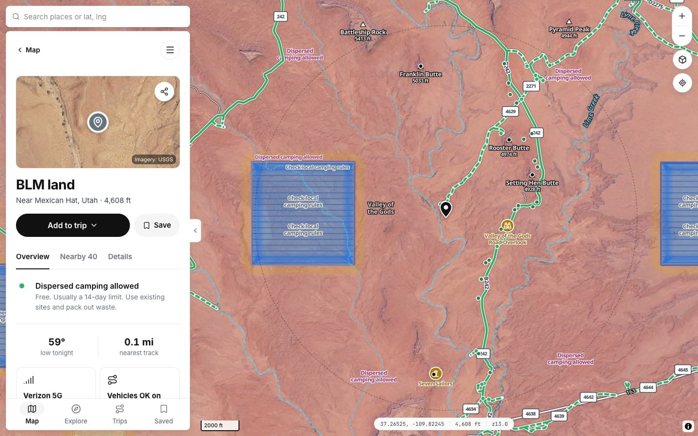
[Tap anywhere on the map and know if you can sleep there, and why.]
YOU GET
[A flat, legal spot by sundown]
YOU CAN TRUST IT
[Every answer shows the rule behind it]
IT'S FAST
[One tap, not three tabs]
IT'S EASY
[No PDFs, no forum threads]
[You've done it the hard way]
WITHOUT OUTSIDER
- [Download the forest's motor vehicle map PDF]
- [Check BLM land in another app]
- [Read a forum post that may be years old]
- [Drive around at dusk hoping]
WITH OUTSIDER
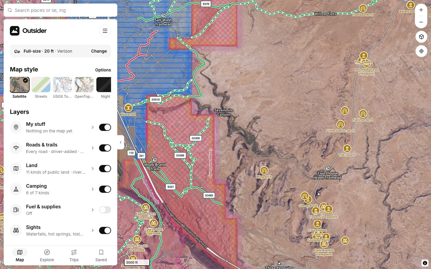
- Camping areas drawn right on the map
- Tap a spot: allowed, designated only, permit needed or no
- The rule, the land manager and the nearest track
- Camps, weather and cell signal around the spot
HOW IT WORKS
[Three taps to camp]
1
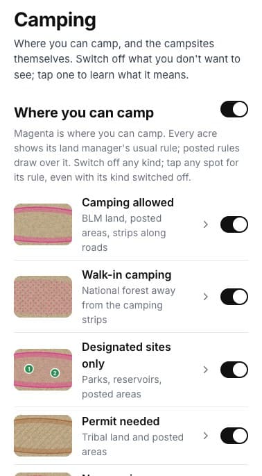
Turn on Camping
Where you can camp shows in magenta, kind by kind. Switch off what you don't need.
2
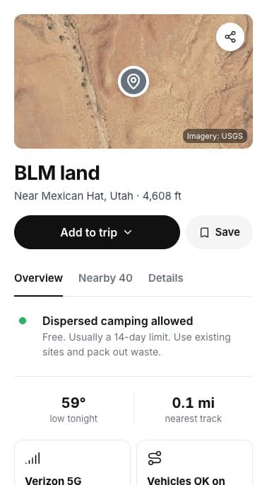
Tap a spot
Get the rule for that exact spot, who manages the land and how far the nearest track is.
3
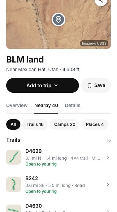
Or pick a campsite
Nearby lists the camps around the spot, closest first.
WHAT THE COLORS MEAN
THE DETAILS
Everything a spot tells you
Drop a pin anywhere. This is what the panel shows.
THE RULE
Can you camp here
Allowed, designated only, permit or no, with the usual stay limit.
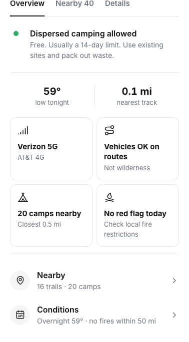
AROUND THE SPOT
Signal, weather, fire
Tonight's low, cell signal by carrier and fire restrictions to check.
ON THE MAP
Every kind of camping
Allowed, walk-in, designated, permit and no camping, each one switchable.
NEARBY
Camps around you
Campgrounds and dispersed sites near the spot, with distance.
ON THE MAP
ON THE SPOT'S CARD
FILTERS
FROM DRIVERS
SCREENSHOTS
See it in the app
Click any screenshot to see what it shows.
WHERE THE ANSWERS COME FROM
Every spot shows its rule
[The camping answer comes from the agency that manages the land, and the card tells you which.]
FROM THE TRAIL
[Drivers who didn't turn around]
[PLACE · ROAD]
“[THE BIG TESTIMONIAL, IN THEIR WORDS]”
[RIG] · [STATE]
“[TESTIMONIAL]”
[RIG] · [STATE]
“[TESTIMONIAL]”
[RIG] · [STATE]
Fair questions
Is it always right?
It shows the land manager's usual rule and any posted rule we've read. Local closures and fire orders change, so check signs on the ground and the fire restrictions on the card.
What does designated sites only mean?
You can camp only at the numbered or marked sites, not anywhere along the road.
What about private land inside a forest?
Private land is drawn separately and needs the owner's permission.
Does it cost anything?
No. Camping on the map is free in the planner.