FEATURES / ROAD STATUS
ROAD STATUS
[Only take roads that go through]
[Every road tells you if it's open for your rig, before you leave pavement.]
YOU GET
[Roads that go through, for your rig]
YOU CAN TRUST IT
[Every road shows its source]
IT'S FAST
[The color is the answer]
IT'S EASY
[No motor vehicle map PDFs]
[You've met the locked gate]
WITHOUT OUTSIDER
- [Print the forest's motor vehicle map]
- [Guess which tracks are real roads]
- [Hit a closed gate miles in]
- [Turn around and lose the afternoon]
WITH OUTSIDER
- Status drawn on every road
- Your vehicle's answer shown first
- Seasonal dates and restrictions on the line
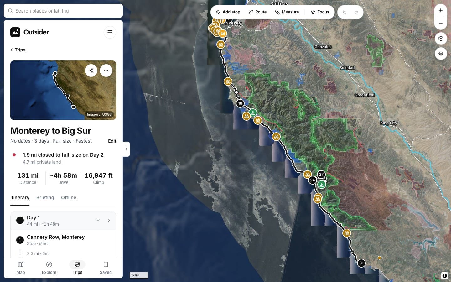
- Length, climb and steepest grade before you go
HOW IT WORKS
[Read a road in a second]
1
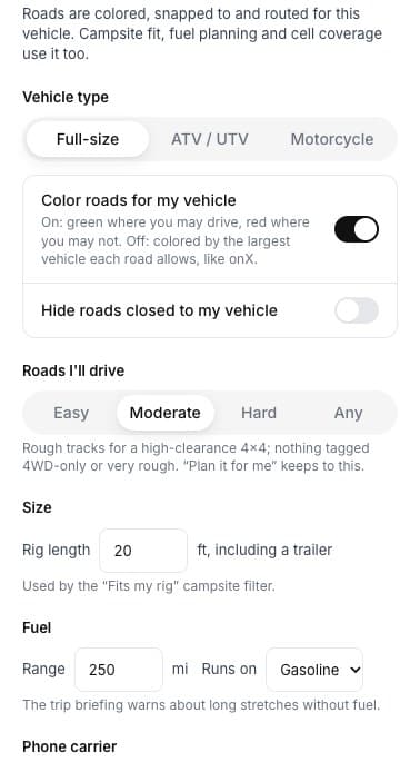
Set your vehicle
Full-size, ATV / UTV or motorcycle, and how rough you'll drive. Once.
2
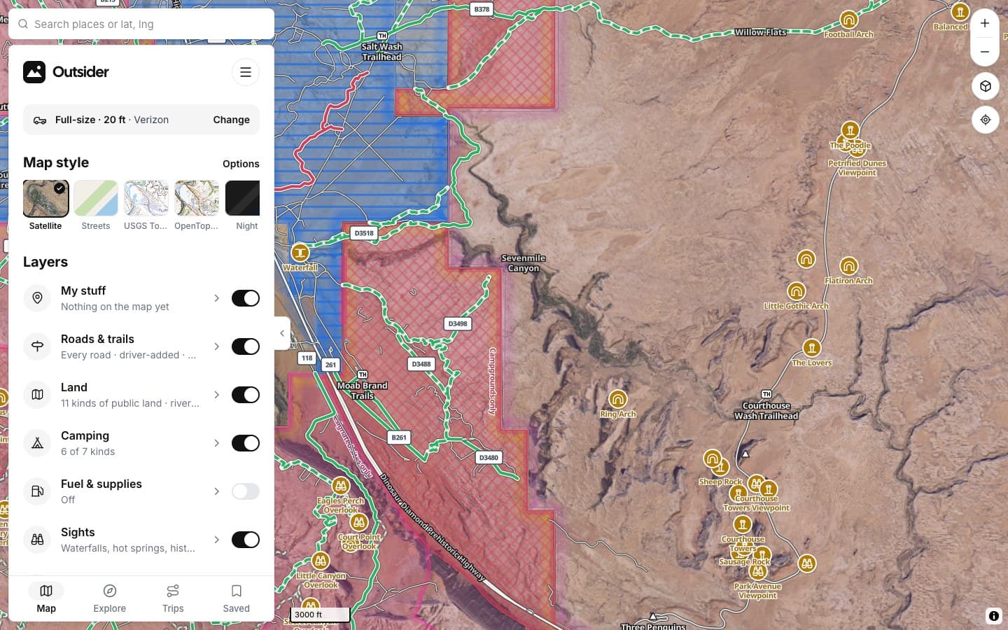
Read the color
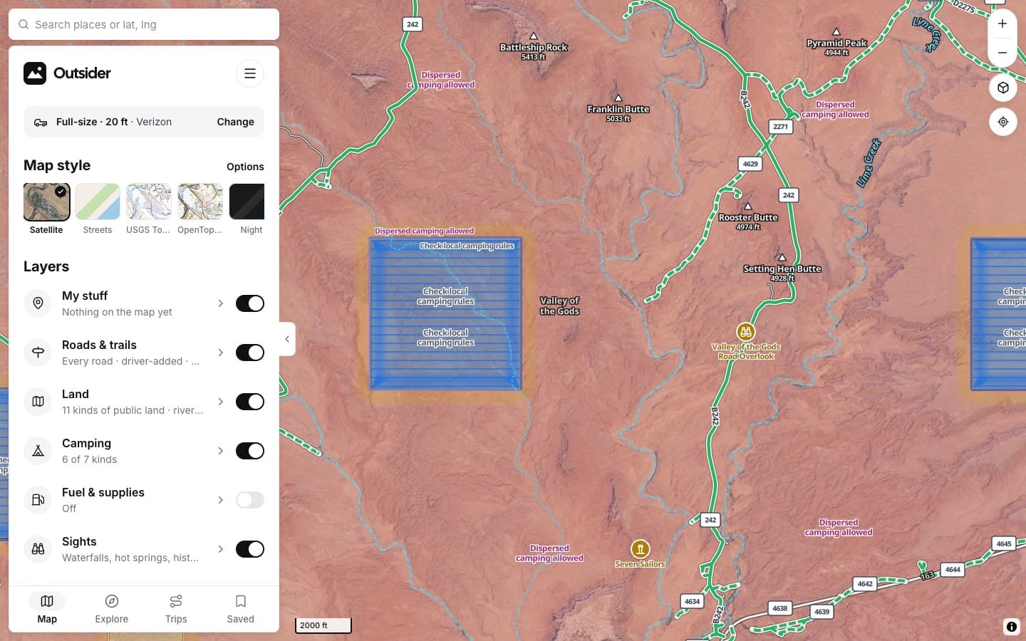
Green is open to your rig, red is closed to it. Patterns show seasonal and restricted roads.
3
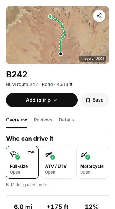
Tap for the reason
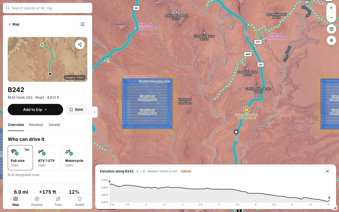
Who can drive it, who manages it, and the numbers for the drive.
WHAT THE LINES MEAN
THE DETAILS
Everything a road tells you
Tap any road on the map. This is what you get.
WHO CAN DRIVE IT
Your rig, first
Full-size, ATV / UTV and motorcycle, each open or closed.
THE DRIVE
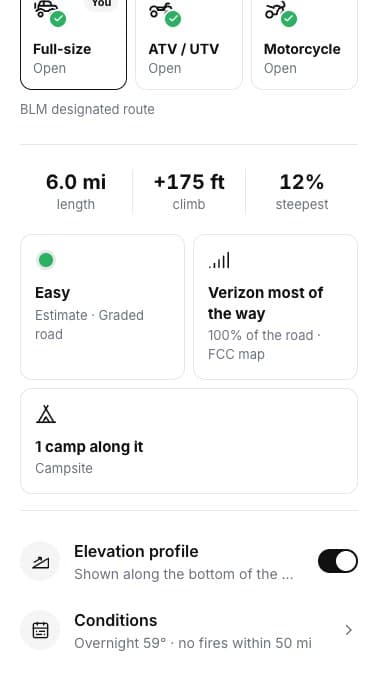
Length, climb, grade
How long it is, how much it climbs and the steepest stretch.
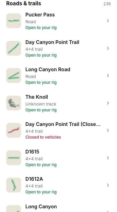
IN VIEW
Every road on screen
A list of the roads in view, each with its status.
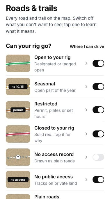
ON THE MAP
Switch what you see
Open, seasonal, restricted, closed, no record, no public access.
ON THE LINE
ON THE ROAD CARD
YOUR VEHICLE
ALONG THE ROAD
SCREENSHOTS
See it in the app
Click any screenshot to see what it shows.
WHERE THE ANSWERS COME FROM
Every road shows its source
[Each status comes from the agency that manages the road, and the card tells you which.]
The source is printed on the card
Under “Who can drive it” you'll see where the status comes from, like “BLM designated route.”
FROM THE TRAIL
[Drivers who didn't turn around]
[PLACE · ROAD]
“[THE BIG TESTIMONIAL, IN THEIR WORDS]”
[RIG] · [STATE]
“[TESTIMONIAL]”
[RIG] · [STATE]
“[TESTIMONIAL]”
[RIG] · [STATE]
Fair questions
Is it always right?
Each road shows where its status comes from. Gates and seasonal dates change, so drivers can report what they find and we update the map.
What does a plain grey road mean?
No agency has an access record for it. It's drawn as a plain road so you know to check before you rely on it.
Can I hide roads my rig can't use?
Yes. Turn on “Hide roads closed to my vehicle” in My vehicle.
Does it cost anything?
No. Road status is free in the planner.
[Your next road, already checked]
KEEP EXPLORING